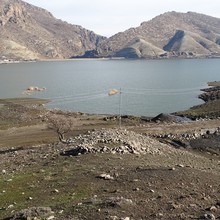
Seeing a prehistoric village on the surface is a remarkable occurrence. Archaeologists were previously familiar with such views from the Mediterranean, such as Malta, Sicily, or Sardinia. Karel Nováček from the Department of History at the Faculty of Arts of Palacký University made a remarkable discovery with his archaeological team: such ancient above-ground visible landmarks from prehistoric times also exist in the Middle East, in one of the mountain valleys of Iraqi Kurdistan. The discovery by Olomouc scientists will significantly contribute to understanding the prehistoric agricultural landscape in the Middle East.
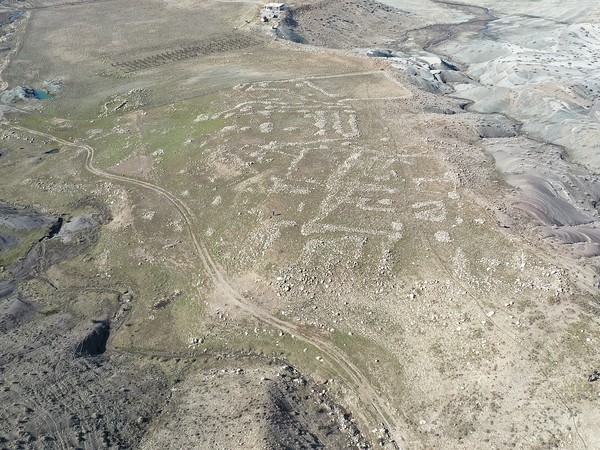
Palacký University has obtained an exclusive five-year license for exploration in Iraqi Kurdistan, located north of the city of Koja. The territory covers approximately five hundred square kilometers. About two months ago, archaeologist Karel Nováček from the Department of History at the Faculty of Arts of Palacký University conducted an initial field survey here with his research group – and the first collected data already brought a unique discovery. In an area of about forty hectares, scientists managed to find a vanished village whose history most likely dates to the mid-fourth millennium BC.
A six-thousand-year-old village with fields in today's Kurdistan provides insights into prehistoric life.
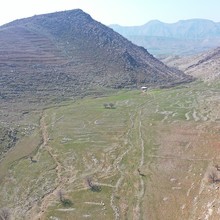
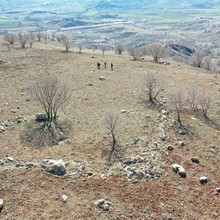
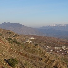
"This area consists of four mountain valleys separated by limestone ridges. Although we are talking about a relatively wild landscape, it is irrigated, fertile, and very suitable for agriculture even in summer. We found that this area is surprisingly rich in archaeological heritage. In a relatively small area, we managed to find many monuments with a history dating back to the Middle Paleolithic. I was personally surprised by the density of the findings in the area. Within fourteen days, we discovered thirty-five archaeological sites," said Karel Nováček from the Department of History at Palacký University. He has extensive experience in field research in Iraqi Kurdistan, which is why Palacký University in Olomouc gained the trust of the local Directorate General of Antiquities, which granted exclusive access to the area for the next five years starting from January of this year.
"In my view, we have an exceptional discovery ahead of us. We have found the prehistoric landscape layout, and if confirmed, our discovery will significantly contribute to understanding the prehistoric agricultural landscape of the so-called Fertile Crescent region," Nováček emphasized the archaeological significance of the site.
During field research, his research group managed to discover a series of vanished villages that are manifested on the surface through stone architecture. To give you an idea: these are not standing houses or ruins, but rather the foundations of structures with adjacent fields delineated by huge stones. Scientists have found a significant number of these objects in the mountains of Kurdistan, some of which have already been verified, while others are available through satellite images.
"The area of the vanished village covers a wide plateau separated from the surrounding areas by deep valleys. No one has previously focused on traces of stone architecture in the mountains of Kurdistan. All archaeologists working in the neighboring regions had previously believed that these were vanished villages from the Ottoman period. However, the ceramics and other archaeological findings we discovered date back to the mid-fourth millennium BC. Of course, there are also findings from later periods," added Karel Nováček. Although he does not consider himself an expert in prehistory, he believes that a specialist will need to evaluate the findings in more detail. However, he is already convinced that in the remote regions of Kurdistan, people established these agricultural systems six thousand years ago and they were either used continuously until around 800 to 900 AD or disappeared during the Bronze Age.
This discovery will provide a wealth of additional information. "If we can map the structure of fields in relation to a settlement, we can learn a lot about how the local people worked with the space, what their economic foundation looked like, how the community was socially organized, or what technologies were used in agriculture at that time. We will gain various pieces of information that contribute to understanding the prehistoric community," explained Karel Nováček.
To utilize the preferential license for access to the specific area in Iraqi Kurdistan, experts must secure funding.
Modern archaeological work no longer relies solely on traditional tools such as measuring tape, trowels, and shovels to investigate archaeological sites. Karel Nováček's team uses the historical espionage system Hexagon to collect data, featuring recently declassified high-resolution images. For mapping archaeological sites, perpendicular aerial images to scale (orthophotos) and 3D models are also essential.
All the gathered information and documentation from the initial field research are currently being processed by archaeologists. They are redrawing the aerial images in geographical information systems and are already working on a plan to return to the actual findings in Iraq, which had to remain behind.
"When leaving the country, we must always submit a final report containing information about the findings. In other words, we are obliged to go through and document the entire collection. In this case, it was very time-consuming because we collected eighty sets of findings in those fourteen days. We already know that the relatively confined valleys there served as intensive communication corridors. As agricultural areas, they were used throughout the prehistoric and historical periods. We need to revisit the submitted collections, and this time with a prehistory specialist," said Karel Nováček. To make it happen and return in the fall, he wants to do his best.
The license, which grants Palacký University preferential access to a part of the territory in Iraqi Kurdistan, is a form of recognition from the local Directorate General of Antiquities. No one other than the scientists from Karel Nováček's team at the Department of History of Palacký University is allowed to conduct archaeological surveys in the specified area for five years. These surveys would not be possible without the collaboration of the Directorate General of Antiquities of Kurdistan, the Cultural Heritage Inspectorate in Koya, the University of Koya, and the Technical University of Berlin. You can learn more about this fascinating topic in a weekend program on Czech Television Studio 6.
Doc. Karel Nováček, born in 1968, originally an archaeologist specializing in medieval studies with a focus on Czech lands, is a member of the Department of History at Palacký University. Since 2006, he has been involved in the study of the medieval urban landscape in northeastern Mesopotamia. He is the primary author of the monograph titled "Medieval Urban Landscape in Northeastern Mesopotamia," which was published in Oxford. Thanks to his research, an exhibition titled "Endangered Architecture of Mosul" was installed in the Gallery of Science and Art of the Czech Academy of Sciences. This exhibition showcased how architectural heritage can be studied remotely, and some of the damaged monuments in Mosul were virtually reconstructed by Czech experts. Towards the end of this year's March, the UP Faculty of Arts Press in Olomouc released his book titled "Medieval Cities of Assyria."
Karel Nováček, as an archaeologist, has been working in Iraqi Kurdistan alongside other experts since 2006. In this region, he works towards the preservation of the world's cultural heritage diversity, and the Iraqi authorities highly value the work of his team. He spent several years acquiring new insights into Islamic medieval architecture, including the unique architecture of Mosul. He established a Czech archaeological mission in Iraq and regularly stays in Erbil. He also participates in various international teams and projects. Since 2019, he has been involved in the conservation of late Ottoman architecture in the Iraqi city of Koja. Leading an international team, he documented eighty valuable houses from the late 19th and early 20th centuries in this historically significant Kurdish emirate. His efforts helped halt the destruction of a prominent structure that once accommodated merchants. The Mahmud Agha Khan is now preserved and awaits funding for its restoration.
